Officer in charge: Dr. Reet Kamal Tiwari
| S. No. | Name of Instrument | Description | Photo |
|---|---|---|---|
| 1 | Plane Table Survey Apparatus | A plane table survey is one of the fastest methods of surveying. A Surveyor can do plotting of plan and field monitoring both at the same time. In the plane table surveying, the geometrical situation of the site is plotted on the map paper using a plane table and alidade, and then topographic details are created on the map |  |
| 2 | Dumpy Level | The dumpy level is an optical surveying leveling instrument consisting a telescope tube firmly secured in two collars fixed by adjusting screws to the stage by the vertical spindle. | 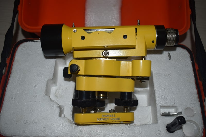 |
| 3 | Digital Theodolite | A digital theodolite consists of a telescope that is mounted on a base. A sight on the top of the telescope is used to align the target. The object in focus is made clear by using a focusing knob. The eyepiece of the telescope is used to find the target. | 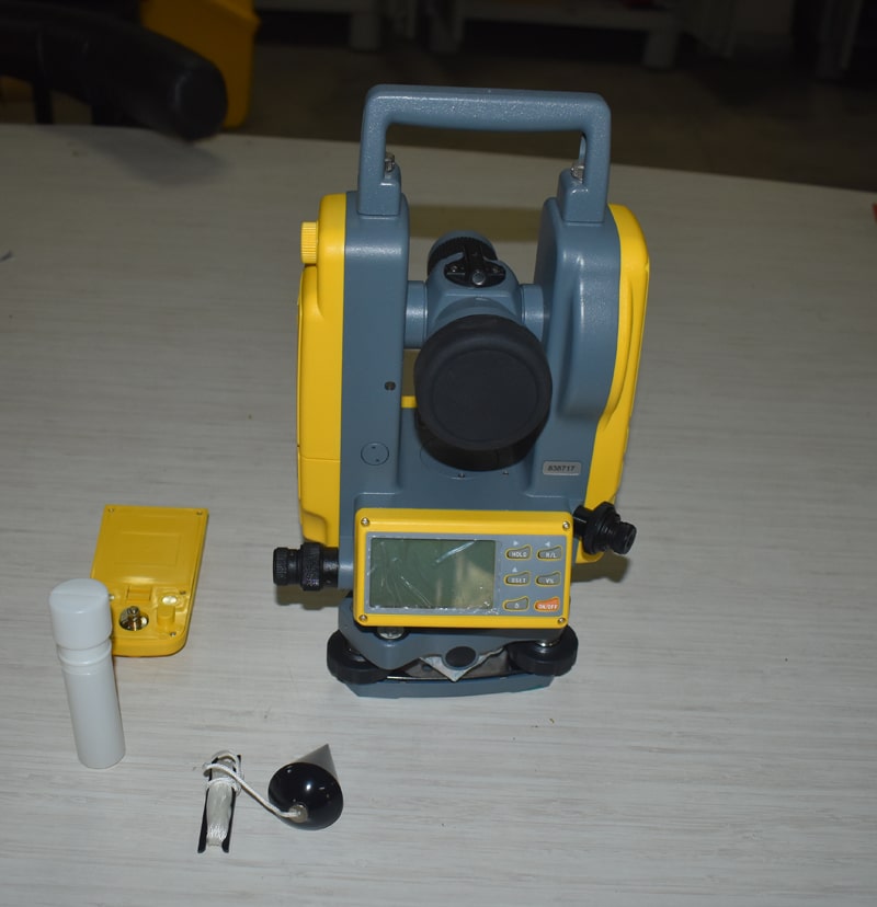 |
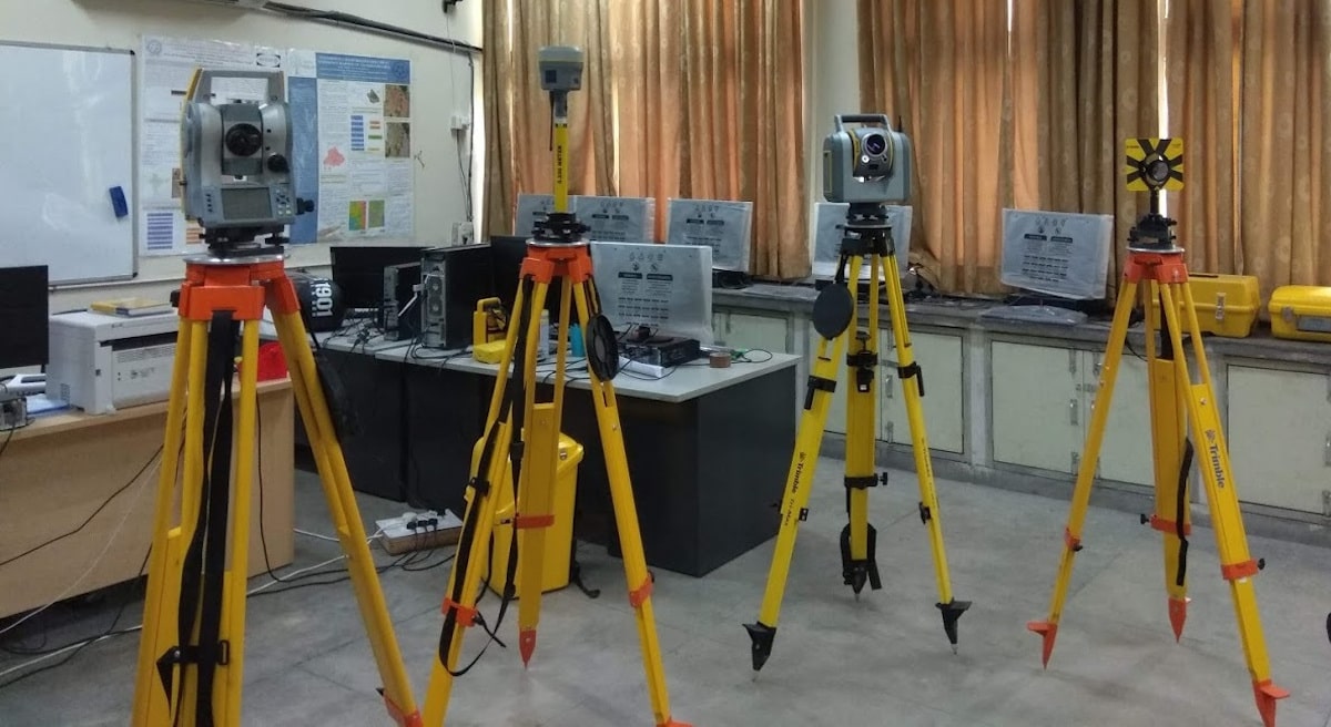
| 4 | Total Station | A total station is an electronic/optical instrument used in modern surveying and building construction that uses electronic transit theodolite in conjunction with electronic distance meter (EDM) | 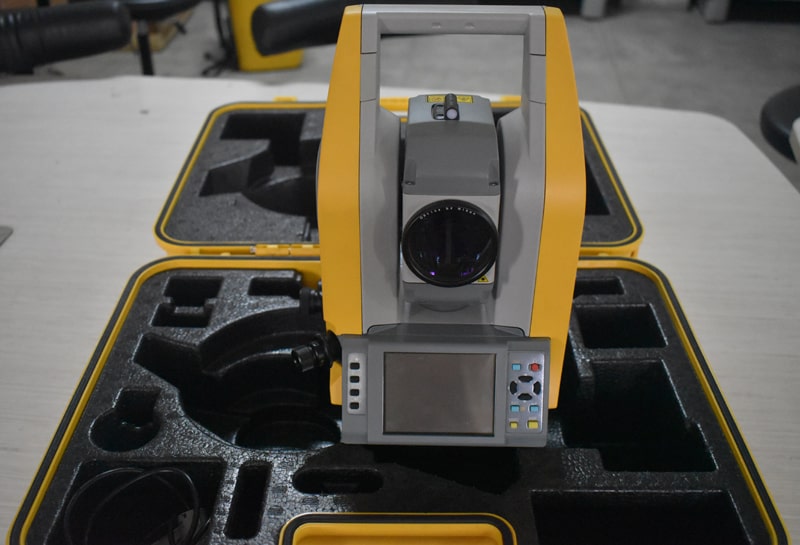 |
| 5 | GNSS Receiver R10 DGPS | When talking about satellite navigation systems, a term you will often encounter is GNSS, which stands for Global Navigation Satellite System. This is the generic name used to describe any global system of satellites that transmit signals for navigation purposes on Earth | 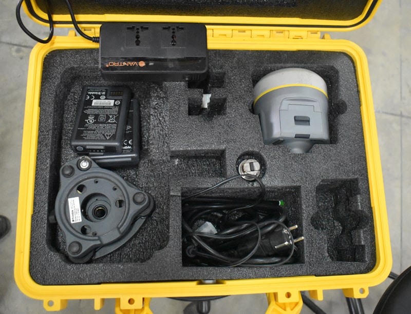 |
| 6 | 3D Laser Scanner | About the Trimble X7 3D Laser Scanner The Trimble X7 is an easy-to-use high-speed 3D laser scanning system with new innovations to simplify adoption and increase efficiency. Features like automatic calibration and in-field registration will ensure data quality and provide confidence in the field. | 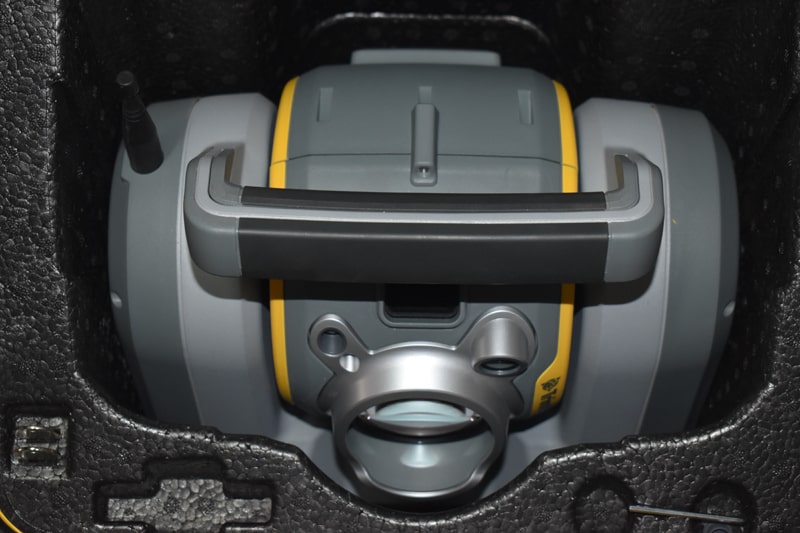 |
| 7 | Levelling Engineers Compass 128 mm & 178 mm Diameter | Compass surveying can be defined as the method of surveying in which the directions of the survey lines is determined by means of a compass and also by using tape or a chain. This measurement is directly done on the surface of the earth. The use of compass as a navigator is a practice followed for centuries. | |
| 8 | Tilting Level | Tilting levels are highly precise levels and should be use in the field where high precision is required. The degree of precision of the level is partly function of sensitivity of level tube, the sensitivity is related directly to the radius of curvature of upper surface of the level tube, the larger the radius of curvature the more sensitive is level tube. | 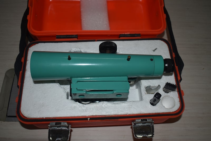 |
| 9 | Nautical Sextant Base Make | A sextant is a traditional navigational tool. It measures the angle between two objects, such as the horizon and a celestial object such as a star or planet. This angle can then be used to calculate the ship’s position on a nautical chart. | 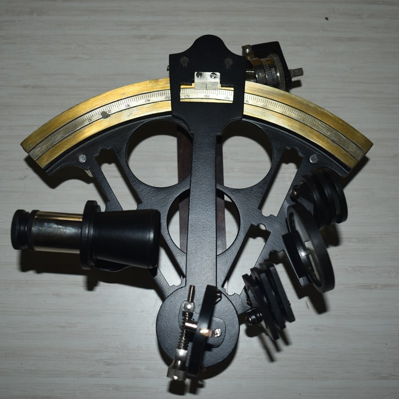 |
| 10 | Parallex bar | The parallax bar is an instrument designed for use with a mirror stereoscope that has a stereo base of ten inches or less. The bar is used to determine the height difference of natural and man made features when viewing stereoscopic photographs | 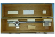 |
| 11 | Digital Tachometer | An instrument which measures the working speed of an engine (especially in a road vehicle), typically in revolutions per minute. | 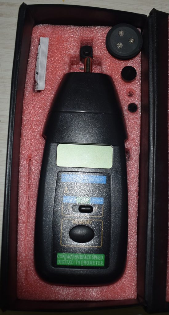 |
| 12 | Planimeter | Planimeter is an instrument used in surveying to compute the area of any given plan. Planimeter only needs plan drawn on the sheet to calculate area. Generally, it is very difficult to determine the area of irregular plot. | 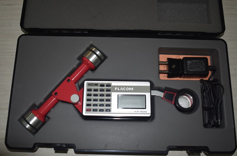 |
| 13 | Telescopic Alidade | Telescopic Alidade is a navigational instrument used on board a ship for taking precise terrestrial bearings of distant objects | 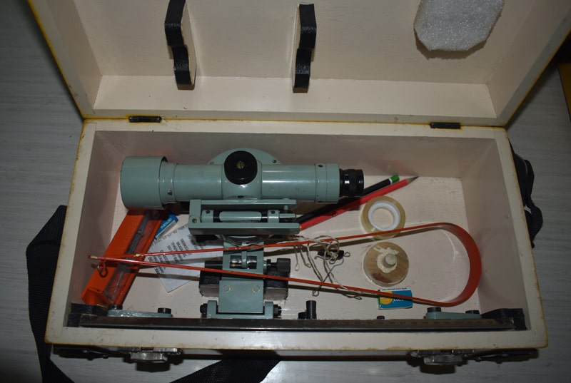 |
| 14 | Theodolite Vernier | Vernier theodolite replaces compass for angular measurements. It can also be used for measurement of vertical angles | 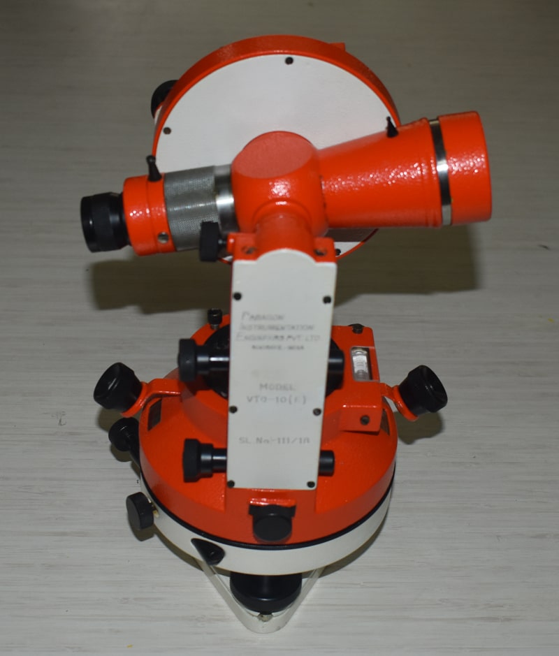 |